
Welcome back!
Did you know that groundwater is one of the most important natural resources? Groundwater is the source of around 33% of the water that is supplied to households and businesses by county and city water departments! Groundwater also provides clean drinking water to more than 90% of rural areas that do not get their water from these public water departments. According to the United States Geological Survey (USGS), about 30% of the freshwater used in the United States came from groundwater sources, while the other 70% came from surface water (Dieter et al. 2017). Water sourced from the ground is specifically vital for parts of the country that do not have abundant surface water sources, such as the arid West. In regard to the Platte River and adjacent Crane Trust properties, groundwater saturates the soils of wet meadows and feeds the surface water of sloughs!
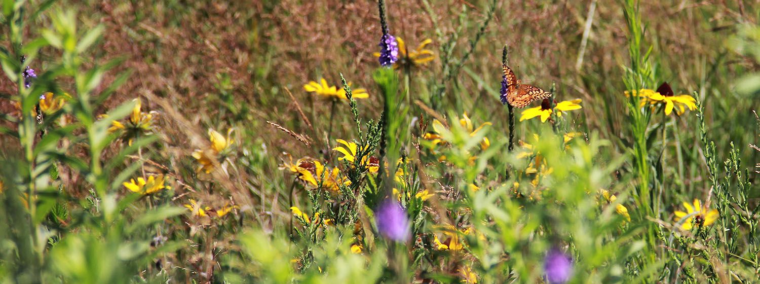
Unfortunately, large scale use of groundwater irrigation for agriculture has led to a drop in the water table and depleted surface water availability in meadows along the Platte River. This drop subsequently saturates the adjacent lowland prairies and wet meadows for shorter periods of time, resulting in the grassland systems becoming less resilient to drought. Not only do these issues influence the important characteristics of the lowland prairies and wet meadows, but these alterations also have an effect on the species that rely on these ecosystems. For the Platte River specifically, these species include migratory birds, especially shore/water/wading birds, such as the endangered Whooping Crane, Piping Plover, and Least Tern. These ecosystems not only provide a food source that is exceptionally important, but they provide necessary cover for resting during long spouts of migration. Without these essential stopover sites, many of the migratory birds, specifically the Whooping and Sandhill Cranes, would not be able to finish the migration to their final destination. Therefore, having a better understanding of where the groundwater levels are throughout the Trust properties surrounding the Platte River will further our knowledge of wet meadow hydrology in general and allow for the Trust to make important management decisions.
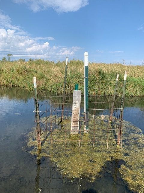
With all of that being said, how exactly does the Crane Trust measure groundwater levels? This week I went out with Joshua Wiese, the Habitat Ecologist, and Matthew Schaaf, the Lila O. Wilson Intern, to learn how water is monitored by collecting and recording groundwater data at 9 sites throughout Crane Trust properties. The sites are either located in a slough (Pictured Above), which detects water depth when surface water is present, or are placed at various well sites in the ground, which detects changes in groundwater level, how the depth of groundwater varies between upland and wetland systems, and how this variation influences the vegetation community.
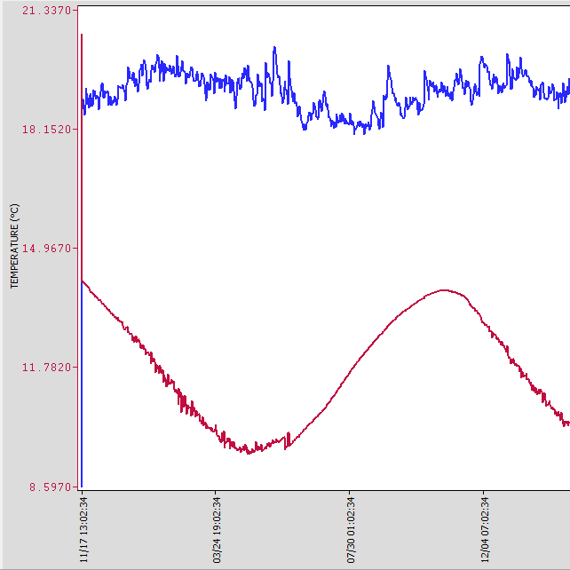
Although the sensors can store up to ten years of data, groundwater sites are visited and downloaded every six months to limit data loss related to issues such as equipment malfunction. Three pieces of equipment are used throughout this process: a water level meter, transducers, and barologger sensor. There are also permanently installed staff gauges that are used to measure surface water and to help verify the accuracy of adjacent transducer readings. Both the transducer and barologger sensors take and record a measurement every hour in order to monitor water fluctuations. Groundwater depth is calculated through a program using atmospheric pressure from the barologger to compensate for pressure changes recorded by the transducer as groundwater depth increases. The program produces a graph showing the water depth in blue and the water temperature in red (Pictured Below). The water level meter is taken on site and is also used to help test the accuracy of the calculation produced by the two sensors.
Though this project only began in 2012, the data collected has provided the Crane Trust a better understanding of the relationship between surface and groundwater and how they are supporting the properties’ lowland tallgrass prairie and wet meadow ecosystems. This project has also allowed for a better comprehension of how these systems remain resilient during periods of drought and how much moisture is needed to sustain our wet meadows.
To learn more about the importance of groundwater and how the Crane Trust continues to conserve and monitor their groundwater sources, visit this link: https://linktr.ee/cranetrustgroundwater
P.S. Have you ever been curious on where and how rain makes its way to our oceans throughout the United States? Well check out this amazing new tool designed by the United States Geological Survey (USGS)! You can place a raindrop anywhere around the country and watch its journey as it makes its way to the ocean! https://river-runner.samlearner.com/
Until next time!
Cheers,
Amanda Medaries